Your cart is currently empty!
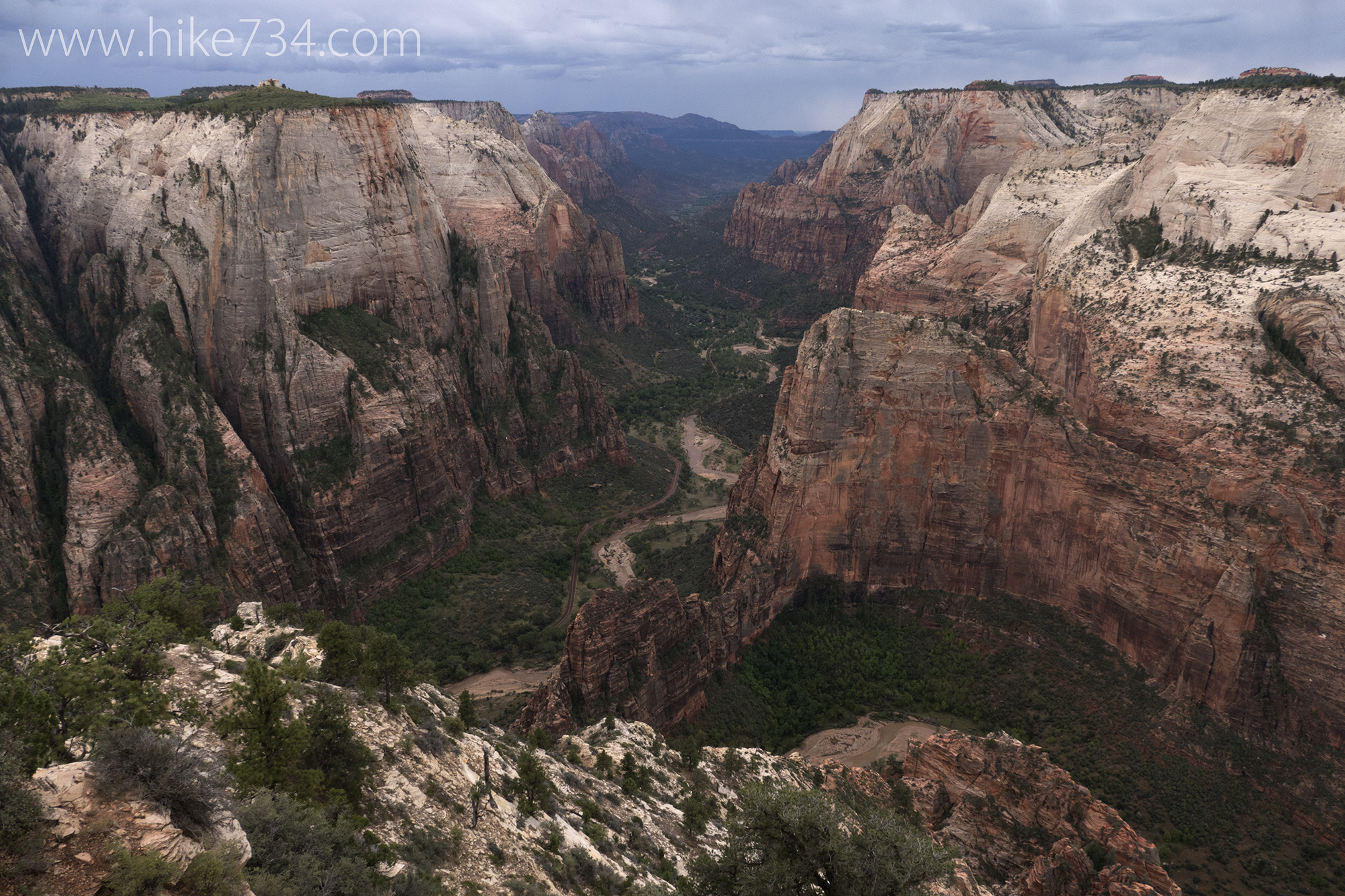
Observation Point
Observation Point – 7.9mi / 12.7km
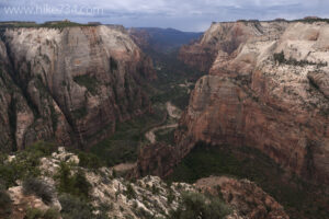
Towering over the northern end of Zion Canyon lies an incredible bird’s-eye view called Observation Point. To see the canyon from this perspective, you have to earn it by hiking up this steep trail.
Starting at the Weeping Rock trailhead, cross the footbridge and continue straight along the paved path (the trail to the left is to Weeping Rock). The path quickly gains elevation. Each step gives you an excuse to take a rest as the views get better. After about a dozen switchbacks, the trail levels off as you enter into the tall walls of one of the narrow sections of Echo Canyon.
In this section, the high walls make it feel like you’re in a large room. Further on, the walls almost completely close in overhead creating a tunnel of sorts. This section is a worthy destination in and of itself. This area can also become very dangerous in the event of flash flooding, so proper attention to the weather is paramount.
Echo Canyon opens back up after the tunnel feature, and the signed trail for Observation Point breaks off to the left. This section of trail, hewn from the rock, is a marvel of engineering. The switchbacks, visible from the bottom of Zion Canyon, take you steadily to the top of the rim. The views from this section of trail that hug the cliffs are nothing short of breathtaking and are not for those with a fear of heights.
Once past the switchback section, the trail primarily follows the edge of the rim where it meets up with the East Mesa Trail and continues on to your destination of Observation Point. Even before you get to the end of the trail, fantastic views down to the Virgin River are exceptional as it comes out of the Narrows. At the actual point at the end of the trail, you see Angels Landing beneath you and further down the rest of Zion Canyon as it heads out to Springdale. At eye level are many of Zion’s signature summits such as Cable Mountain and The Great White Throne. From this point, turn around and head back down.
Another less popular option for getting to Observation Point is via the East Mesa Trail. This route is slightly shorter in distance and a lot less vertical overall. Getting to the trail involves a five mile drive along the North Fork Road east of the Park’s East Entrance, then a left turn onto the signed dirt road to Zion Ponderosa Ranch & Resort. This road is on private property, so please be respectful to the landowners and stay on designated roads and trails. Signage is limited, so refer to the map and follow the more heavily used roads to get to the trailhead. Rainy conditions or snow covered roads may make the road impassible with a car.
Trailhead: Take the National Park Service’s free shuttle to the Grotto stop in the main Zion Canyon or drive the Zion Canyon Road if the shuttles aren’t running and the road is open to private vehicles.
Elevation Gain: 2,300ft / 690m – Elevation Loss: 2,300ft / 690m